A Map at the Museum
Posted July 22, 2014 at 11:23 am by Tim Dustrude
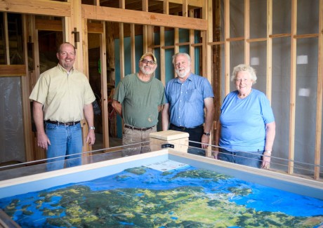
L-R: Kevin Loftus, Museum Director; Fred Yockers, designer/builder; Don Nixon, museum board member; and Mary Jean Cahail, Museum President – San Juan Update photo
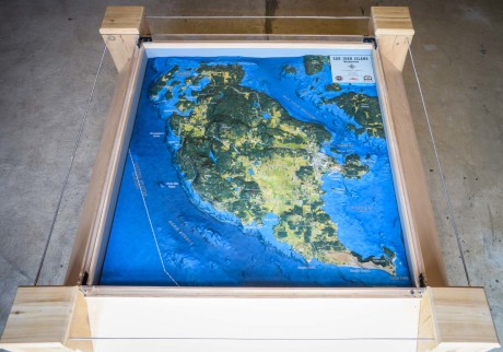
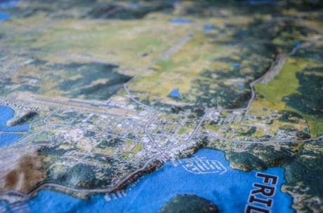
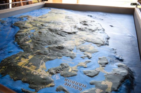
There is some cool stuff going on over at the San Juan Historical Museum – they’ve just added a major part of their new exhibit within their developing Museum of History and Industry (MHI). It’s a relief map of San Juan Island, and it’s completely to scale (meaning that the heights of mountains and the depths of valleys and the sea floor, are correct in proportion to linear distances across the map), so it is a very accurate model of our island and its topography.
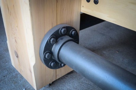
According to Museum Director Kevin Loftus, Don Nixon and Fred Yockers deserve all the credit for its production and the Honeywell Charitable Fund of the Community Foundation of the Rappahannock River Region and Valmark, Inc., for providing funding for the project. Fred designed and built the table/display out of native island cedar (donated by Bill Maas at Egg Lake Sawmill and Shake, which was planed smooth thanks to Dave Marsaudon at Windowcraft), and Don worked meticulously on its design and detail and functionality. Click for more info and more photos…
It began as 2 big, flat chunks of high-density foam at the company Solid Terrain Modeling, where it was carefully “sculpted” with a computer controlled machine which also printed the satellite image. Then the 2 pieces were joined together and voila – there was a map of the island. Put it in a beautiful custom-made cedar display table and you have a wonderful addition to the museum!
It’s not totally finished yet – in its final form, it will have labeled buttons around the perimeter for various points of interest – push a button for “Lime Kiln Park” for example, and a light will illuminate, showing you where that is. There will also be screens mounted on one side which will give more information about these various locations.
For the new MHI exhibit which will showcase the 4 major industries that shaped the island’s culture and economy (Fishing, Logging, Farming and Lime), this map will be the centerpiece that ties them all together. It will be the first thing you see when you enter the atrium. As you can see in the photo at the top of this story, construction of the interior walls is underway. These will allow the building to be insulated and heated so that it will be a nice place to visit even in winter months.
The map will be on display at the SJ County Fair, but if you really want to see it, and can’t wait that long, go to Island Rec’s Music on the Lawn on Wednesdays, and just show up a few minutes early – they’ll have the doors open specifically so people can check it out. And if you can’t make it there, they also said that it can be viewed pretty much any time the museum is open if you make an appointment ahead of time (because they have other stuff to do too, besides showing off the map all the time). But they really want people to see it so they look forward to hearing from you. 378-3949.
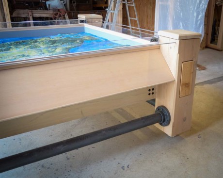
Four wood “blanks” like the one on the leg there will be replaced with carvings by Terry Ogle, depicting the 4 major industries in the exhibit – Fishing, Logging, Farming and Lime – San Juan Update photo
More information is coming soon in an official museum press release. We will have that for you here as soon as it’s available.
You can support the San Juan Update by doing business with our loyal advertisers, and by making a one-time contribution or a recurring donation.
Categories: Around Here








No comments yet. Be the first!
By submitting a comment you grant the San Juan Update a perpetual license to reproduce your words and name/web site in attribution. Inappropriate, irrelevant and contentious comments may not be published at an admin's discretion. Your email is used for verification purposes only, it will never be shared.