Mapping the San Juans Redux
Posted August 18, 2015 at 5:54 am by Tim Dustrude

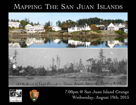
Have you ever wanted to go back in time? Maybe to see what the islands looked like more than one hundred years ago? Local Historian, Boyd Pratt, National Historic Park’s, Mike Vouri, and the Land Bank’s Doug McCutchen will be presenting a free three-part slideshow we are calling “Mapping The San Juan Islands” THIS Wednesday at the San Juan Island Grange.
The talk focuses on the U.S. Coast and Geodetic Survey’s operations in the region during the middle to late 1800s which produced exquisitely detailed maps of the islands including land cover, structures, and accompanying descriptive reports detailing their experiences, including with over 150 photos of the archipelago.
Vouri will present on the early surveys – why the Coast Survey was formed, their early work, and what they were doing in the Northwest. Pratt picks up with the 1888-1890 surveys, exploring how the surveys were conducted and the cultural fabric of the islands in this important formative period. McCutchen finishes the presentation with a series of “now and then” photographs demonstrating the change over time.
You can support the San Juan Update by doing business with our loyal advertisers, and by making a one-time contribution or a recurring donation.
Categories: Around Here


No comments yet. Be the first!
By submitting a comment you grant the San Juan Update a perpetual license to reproduce your words and name/web site in attribution. Inappropriate, irrelevant and contentious comments may not be published at an admin's discretion. Your email is used for verification purposes only, it will never be shared.