


The San Juans, Then and Now
Posted September 19, 2014 at 5:55 am by Tim Dustrude
 Join Boyd Pratt, Doug McCutchen and Mike Vouri for an evening of viewing 1890s images of the San Juan islands by the U.S. Coast Survey’s John Gilbert, scheduled 7 p.m., Friday September 26 in the San Juan Island Library.
The program is free. Contact the park at 378-2240, ext. 2226 for information.
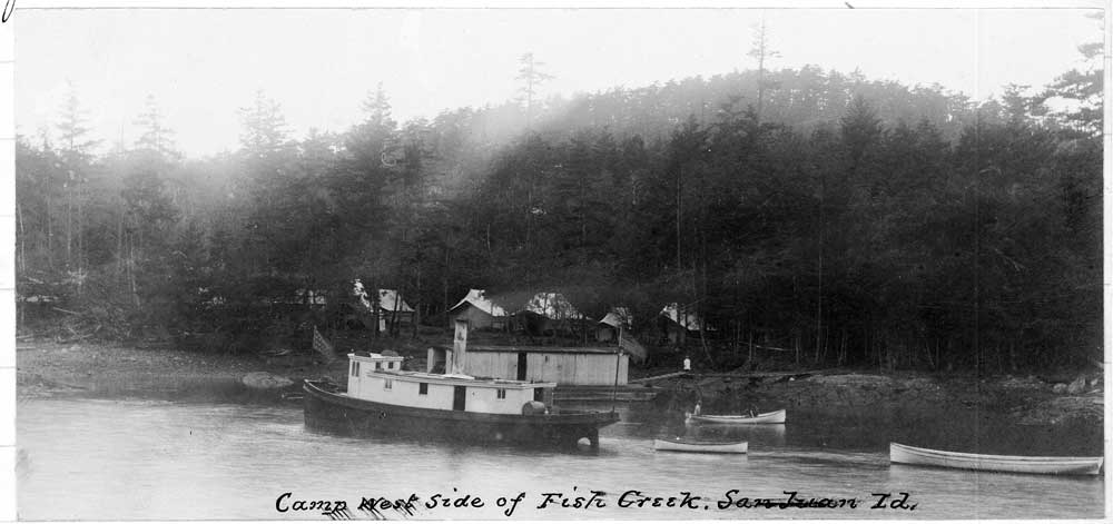
Vouri will open the discussion with a look at the first survey of the islands by the Coast Survey’s naval assistant, Lt. Cmdr. James Alden, and surveyor and map maker George Davidson operating from the U.S. Coast Steamer Active from 1853-1860. Pratt will follow with insights on Gilbert’s land-use T-sheets. McCutchen will then present a series of slides that capture from the same perspective today the sites of Gilbert’s images.
As an Assistant (a formal title) , Gilbert accomplished most of his San Juan Islands survey in the Fuca, a 45-foot (12 feet abeam with a 5.5 foot draft) steam launch built by J.F.P. Mitchel in 1882. The Fuca was in service from 1882 to 1904 on the Pacific Coast and served Gilbert well in the Strait of Georgia surveys for most of that period. The hydrographic survey, meanwhile, was being done by Lt. J.N. Jordan with the schooner Earnest.
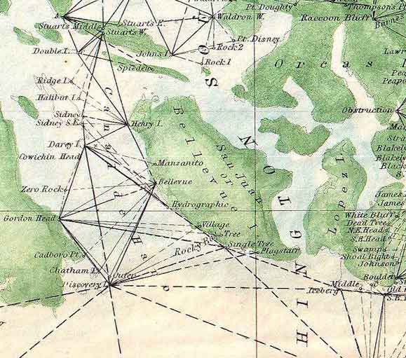
Gilbert’s topographic maps (known as “t-sheets”) of the San Juan Islands reveal not only details of coastlines and land cover (including agricultural uses), but are also accompanied by lucid narratives and photographic images that capture the islands and surrounding regions before 20th-century development. The t-sheets were largely forgotten documents until reintroduced on web sites of Washington State University and the University of Washington. A thorough analysis of the t-sheets has been done by Tom Schroeder, whose website can be found at http://www.rockisland.com/~tom/index.html.
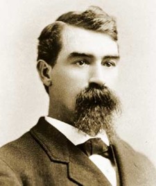
Born on Sept. 4, 1845, at Lewinsville, Fairfax County, Virginia, Gilbert was appointed in the Coast and Geodetic Survey on June 1, 1864, during the tenure of Prof. A. D. Bache, a great grandson of Benjamin Frankolin anbd the leader who ordered the first West Coast survey in 1849. He served under 10 more directors until his retirement in 1921, which also included work in Alaska and the Philippines. He also served as chief of the Division of Hydrographic Operations.
His obituary included this passage about his work in the Strait of Georgia:
“The unparalleled record for continuous surveying operations in one locality was held by Captain Gilbert, who after about 22 years of work in the Georgia Strait, Washington, had won for himself the distinction of having made not only the pioneer, but the unchallenged, development of that region and of the waters south of it. His original records are as current now as then, except for water-front revisions resulting from the natural consequence of industrial growth. Although some of the modern-day methods and instruments were lacking, he was yet able to produce substantially as accurate and thorough results as are possible today.”
You can support the San Juan Update by doing business with our loyal advertisers, and by making a one-time contribution or a recurring donation.
Categories: Around Here
No comments yet. Be the first!
By submitting a comment you grant the San Juan Update a perpetual license to reproduce your words and name/web site in attribution. Inappropriate, irrelevant and contentious comments may not be published at an admin's discretion. Your email is used for verification purposes only, it will never be shared.